|
|
|
|
|
|
|
|
Forcola di Livigno CH/I Data
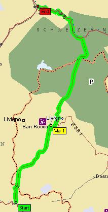
General information Tax free shopping is the main reason for most of the tourists coming here on weekends during the summer, thats why you have sometimes to wait quite a long time at the customs back into Switzerland (unleaded fuel 1000Lira/liter, alcoholic beverages, tobacco, clothes stores). Customs: Sometimes it takes quite a while to convince officers that a GPS unit is not the same as a radar detector (which is illegal in CH) If you have time go hiking in the Swiss/Italian National Forests - one of the best alpine nature reservations !!! If you're lucky you can see eagles, ibex, chamois and many groundhogs. Road description
From Livigno you can reach the Umbrail (2501m), Bernina (2328m) or Zernez. The way to Zernez seems to be in an avalanche territory so you drive a big part of the distance under a gallery. After that there is a narrow tunnel (one way, changing every 20 minutes, 8.-sFr toll) that leads to Switzerland. © by Atic.org in Okt. 1999 |