Maloja
 |
Switzerland/ Maloja |
tour provided by: Adrian Burkert |
Tour
Maloja
Data
| Height of pass: |
1815 m |
|
| Slope: |
9 % |
|
| # of turns: |
|
|
| Best season: |
|
|
| Time: |
33 min |
tunnel / pass |
| Distance: |
25.2 km / 34.1 km |
tunnel / pass |
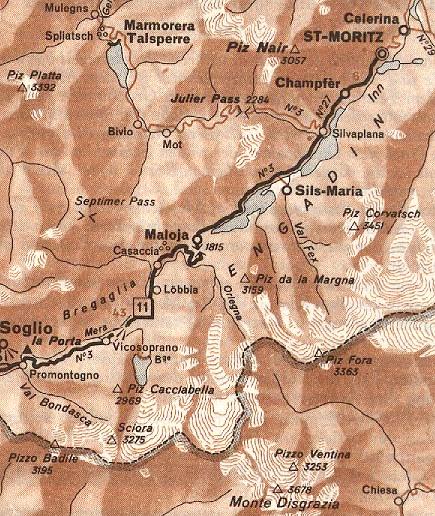
| Roadmap: |
Map of the pass |
GPS Data |
| Location |
Coordinate [WGS84] |
Type |
Services |
| Catasegna |
46° 20' 01.7'' N 009° 30' 48.6'' E |
village |
all services |
| St. Moritz |
46° 29' 57.4'' N 009° 50' 20.6'' E |
town |
all services |
| Silvaplana |
46° 27' 32.8'' N 009° 47' 36.1'' E |
village |
|
| Maloja |
46° 24' 26.0'' N 009° 41' 45.9'' E |
pass |
restaurant, restrooms |
Pictures
General information
Road condition: good
Customs I / CH halfway up.
Road description
[From Catasegna to St. Moritz]
At first the pass starts with a few small
villages situated at the flank of the mountain. Soon you reach customs
and then the road is straight to the end of the valley where hairpins of
all kinds make your day !
After maybe 20 hairpins you reach the 'pass'
- a nice view down and up to the snowy mountains.
The speciality of this 'pass is that on
the other side there is no valley but a high plateau falling only very
slowly ...
A nice and easy ride along the lakes to
St. Moitz.
WWW Links
© by Atic.org in Okt. 1999