|
|
|
|
|
|
|
|
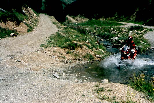
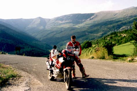
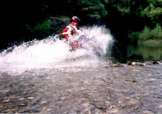
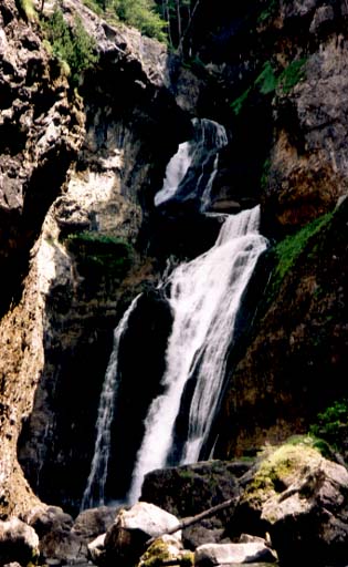
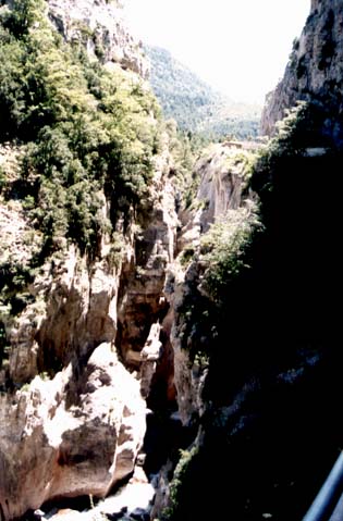
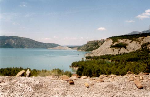
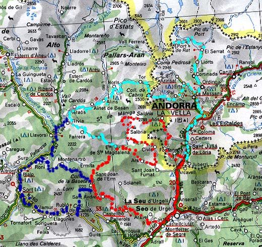
Jump directly to ... Start EMBALSE DE YESA, tour between PAMPLONA and JACA Route If you come from France: To start at BAYONNE gives you multiple ways to enter Spain. You can follow the coast at the N 10 via St. JEAN-DE-LUZ and the D 912 to HENDAYE to the border at IRUN and take the way over SAN SEBASTIN to PAMPLONA. As a good alternative you can follow the N 121a to come to PAMPLONA. An other chance is to take the way through the inland region. If you reach BIARRITZ you should take the D 923 till CAMPO LES BAINES. There you can follow the D 20 and the N 121b to reach also the N 121a. A nice variation happens if you went to St. JEAN-PIED-DE-PORT and when take the D 15, D 948 (13% gradient),and D 58 direction PAMPLONA or D 933 to the Pto DE IBANETA (1057 m) to AURITZ. At AURITZ instead of the N 135 to PAMPLONA, direct at the NA 172 to AGOITZ, the NA 150 to LUMBIER and the N 240 to YESA at the so called lake. Near the lake you can find two campsites. The N 240 follows the lakeside and have a lot of nice curves. At the dam is a small snack bar where some Spanish bikers meet on weekends. Try a little small talk and take a view at the imposing waterfall at the dam. It is also a nice point to start some tours. SMALL TOUR Follow the lakeside in direction HUESCA. At the end of the lake left on the A 137 direction FRANCE. There is a street with lots of curves following the RIO (River) ESCA through a nice valley. With a little luck you can watch some vulture.Through BURGUI and RONCAL the way up takes you to the COLLADO DE LA PIEDRA S. MARTIN (1760 m). This is there the FRENCH border is. If you want you can go on at the D 132 direction ARAMITS and the D 918 direction TARDETS and back to SPAIN on the D 26. Otherwise ride back and take the way before ISABA and cross the ALTO LAZA (1129 m) to the Pto DE LARRAU (1573 m). This is also a point at the FRENCH border. To come back to the lake you can take the way via ESCAROZ, NAVASCUES and LUMBIER or ESCAROZ; ARIBE, AGOIZ and LUMBIER. Make your own decision. Also nice to go is the way from ANSO to RONCAL and from PUENTE LA REINA DE JACA to HECHO. LONG TOUR Follow the lakeside in direction HUESCA. At the end of the lake right via the A 1601 to SOS DEL REY CATOLICO. Near that road (near the lake) we found a place where the vultures get some food. As we have been there hundreds of them had a little dead pig for dinner. At SOS a small road crosses the mountains to UNCASTILLO. After that little town you can drive a lot of kilometres through the SIERRA DE SANTO DOMINGO on the A 1202. There are a lot of nice curves and not very much villages.Unfortunately it seems like a part of the road will be made new with less curves. After a while you reach AYERBE. Then take the N 240 (or A 240?), to the EMBALSE DE LA PENA (nice lake) and via PUENTE LA REINA DE JACA back to the point we started. Start PARQUE NACIONAL DE ORDESA, near Torla Route To get there (directly from the EMBALSE DE YESA) you can follow the N 240 to JACA, than the N 330 and the N 260 to BIESCAS and finally the extreme curvy road to TORLA. If you have a little more time you can take the N 330 from JACA to FRANCE, crossing the PUERTO DE SOMPORT (1632 m).Near ESCOT, a funny little road reaches the COL DE MARIE BLANQUE (1035 m) and you will arrive BIELLE in the other valley. Go on via LARUNS (here you can make the highest French Pyrenees-passes; the AUBISQUE (1709 m), the TOURMALET (2115 m), the ASPIN (1489 m) and many more.) and the D 934 to the COL DU PORTALET (1794 m). Finally you reach BIESCAS again. You can reach the national park on a small street direct from TORLA. At the end of the road is a big parking lot, because inside the park you are not allowed to use a car or a bike. Only your feet. I walked one hour inside and reached some waterfalls at the half way up. If you want you can reach the high region of the park and stay in some cottages. At the little road, on half the way from TORLA a little off-road section starts. A small way goes left into a gorge. It�s only for 3 Km, then you reach the border of the national park and you are not allowed to go on. For fun you can cross two times a small water section. Another tour takes you from TORLA back to BIESCAS and a piece of the tour back to the POUORTALET. Near BUBAL you follow a little lake. Beyond the lake, at the right the HU 610, with nice curves brings you to PANTICOSA. The street ends there in BALNEARIO DE PANTICOSA, a very nice old health resort with lots of tourists. FIRST TOUR From TORLA to BROTO on the N 260. Again lot's of curves, but they are going to build a new road with less curves.?. Short before BOLTANA on the right side a small road (A 1604) starts his way between the SIERRA DE GUARA and the SIERRA DEL GALARDON. It's a very lonely road, you only pass one or two little towns (LAGUARTA).A little river near the road gives you the chance to cool down sometimes. Finally you meet the N 330 again and follow her in direction JACA. Near SABINANIGO you have to follow the N 260 again and reach BIESCAS to come back to TORLA. SECOND TOUR Again to BROTO, direction AINSA. Near SARVISE on the left side a small road brings you to FANLO. Here you will get a nice view at the national park.Follow the small road to ESCALONA, via BUERBA, just to travel through the very nice gorges of ANISCLO back to FANLO. Because of the huge crowd of tourists in summer, the gorge is only to pass in one way, because it is a very small road. If you want to drive a little longer take the A 138 from ESCALONA to BIELSA. You can branch off at HOSPITAL up to REVILLA and at BIELSA up to the PARADOR MONTE PERDIDO. A special branch off may be in SALINAS DE SIN. Take the way to PLAN and to SAN JUAN DE PLAN. A few kilometres before SAN JUAN in the middle of a curve a longer off-road section begins and bring you into an other national park. You can follow the way in direction VIADOS, always near a little river. The road sudden ends far up near a little cottage. This is a longer off-road section. [eventually you can also go from PLAN to BARBARUENS or to CHIA. See also map MICHELIN NR. 443] Start CASTELLBO near LA SEU D' URGELL, direct next to ANDORRATwo maps can be found on this link and if you klick here. ! Route If I am in this part of SPAIN, I try not to stay in that overcrowded ANDORRA. I stay in CASTELLBO, a very small village in the mountains nearby. It is a good point to start several tours if you want. I was there at last in 1994. It is one of my favourite offroad areas.How's to go to:
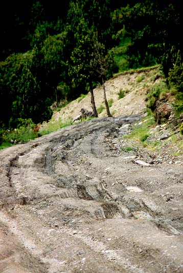
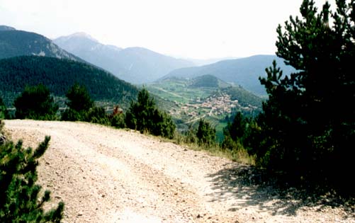
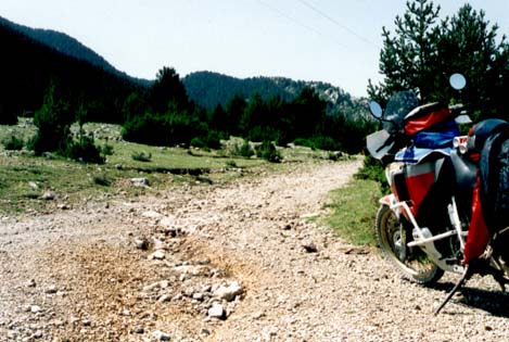
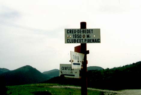
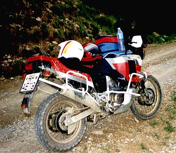
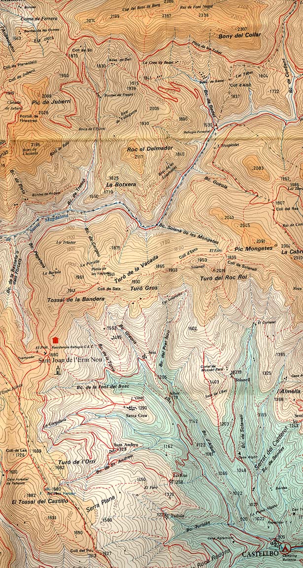
OFFROAD From CASTELLBO (809 m) a small street takes you up to the SANT JOAN DE L�ERM (1690 m). There you find a small cottage and a barbecue. Here is the start for several different offroad trails. If you take the first way on the right side (on the end of the parking place), the road brings you down to a little river. After a while you have to cross that river at a small ford. At the end of that little valley you reach a small chapel (ETA DE Sta MAGDALENA) and the road splits off in two directions.One way (right) goes to ARS, crossing the COL DEL RAS (1907 m). If you arrive in ARS you will have the chance to go to SERRAT DE ROQUES BLANQUES and on, to CIVIS and than over the COL D� ARES (1865 m) to the PISTA DE LES TOBES. The other way is to go left and up to the LA CREU DE BEDET (1941 m), then right on the PISTA DE LES TOBES to the COLL DE CONFLENT (2154 m) and without border control to ANDORRA, to reach AOS at a ski station. At the LA CREU DE BEDET you can also go on to the COL DE SO (1870 m), through FERRERA (1362 m) into the neighbour valley. If you have time, go on to TIRVIA and up again to ARAOS, straight to TOR and offroad to PAL in ANDORRA. The way back depends on you. Another way takes you from SANT JOAN DE L�ERM through MONTENARTRO (1298 m) and RONI into the neighbour valley. Than you can go to ANDORRA again or take the way back through SORT and the N 260 over the COL DEL CANTO (1725 m) to ADRALL and back to CASTELLBO. Last but not least you can reach the COL DEL CANTO on a track from the SAN JOAN. SIERRA DEL CADI First you have to go to LA SEU. Then a small road takes you up into the SIERRA DEL CADI. A permanent rising way takes you up to EL GES, to FORNOLS and on to TUXIEN. Now you can think about which way you choice. You can go through JOSA DEL CADI and SALDES down again on the other side to the C 1411, then to BERGA and back on the L 401. Or take the way through LA COMA to the COLL DE JOU and the L 401. Alternative: take the way MONTAN, SORRIBES. Just try out all that funny little roads in a altitude near 2000 m and make your experience.SIERRA DE BOURMORT From CASTELLBO down on C 1313, direction LLEIDA. Six kilometres beyond ADRALL a small road on the right side takes you to NOVES DE SERGE and CASTELLS into the SIERRA DE BOURMORT. Then I have a little problem to describe the way, because as I was there last time we arrived at a house near a small river. I asked a woman for the way to the neighbour valley. She said there is no way and it is too dangerous (I said "No problema con Enduro?!" and she answered "arriba, arriba, problema, problema!!" ). So we turned back and took the next way left. This was a very nice way up through the hills to the COL DEL CANTO.PORT DE RAT Easy to drive (only the last kilometres are offroad ): way to the PORT DE RAT (2540 m) (see ENDUROATLAS 1) in ANDORRA.. At the end of the way you find a closed tunnel in which you can walk ca. 100 m (if you have light!)
Special tips
Andreas Lienhardt put together some fantastic Web ressources about Spain and Andorra.
Pictures of Spain/ Pyrenees
Picture-Count: 15
© by Atic.org in Okt. 1999 |


